Charcoal Production Monitoring Portal
Charcoal Production Monitoring Portal is developed by CERSGIS, with support from USIAD/NASA uder the SERVIR West Africa project
Charcoal Production Monitoring Portal is developed by CERSGIS, with support from USIAD/NASA uder the SERVIR West Africa project
Charcoal Production Monitoring Portal is developed by CERSGIS, with support from USIAD/NASA uder the SERVIR West Africa project.
The Charcoal Production Site Monitoring Service, a joint initiative of SERVIR-PCU, NASA SCO, AST, A Rocha and CERSGIS to help developing countries use information provided by Earth observing satellites and geospatial technologies for identifying charcoal production sites and associated changes in woody vegetation cover on a regular basis.
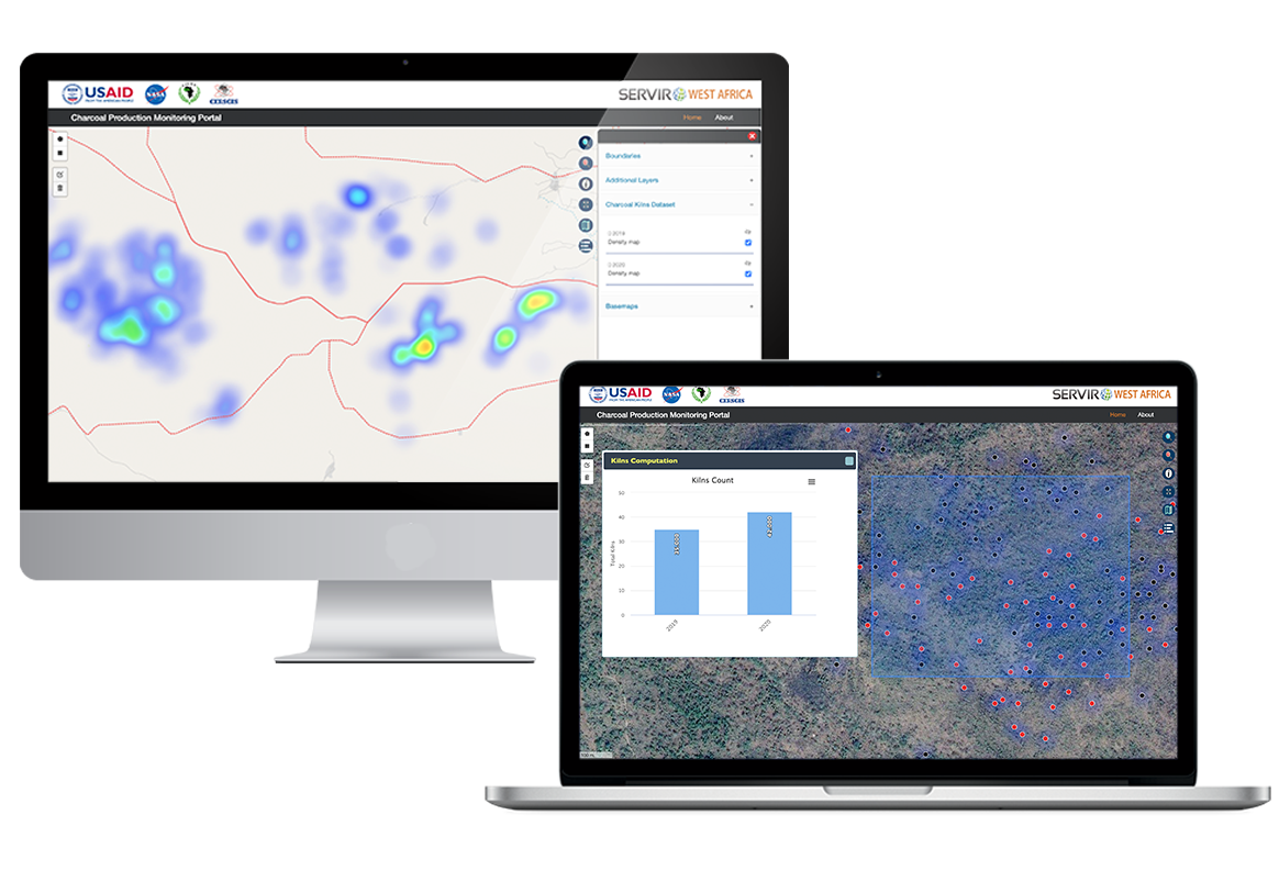
The Monitoring Service is a web-based platform for visualizing the spatial distribution of charcoal production sites, thereby facilitating forest degradation monitoring in the study areas. Very high-resolution imagery from Google Earth and remote sensing data from Landsat 7 and Landsat 8 will be used to identify charcoal kilns and the production of tree cover density maps. The information will aid in the monitoring of tree cover loss for estimating carbon emissions and for district-level land use planning purposes.
Visit Portal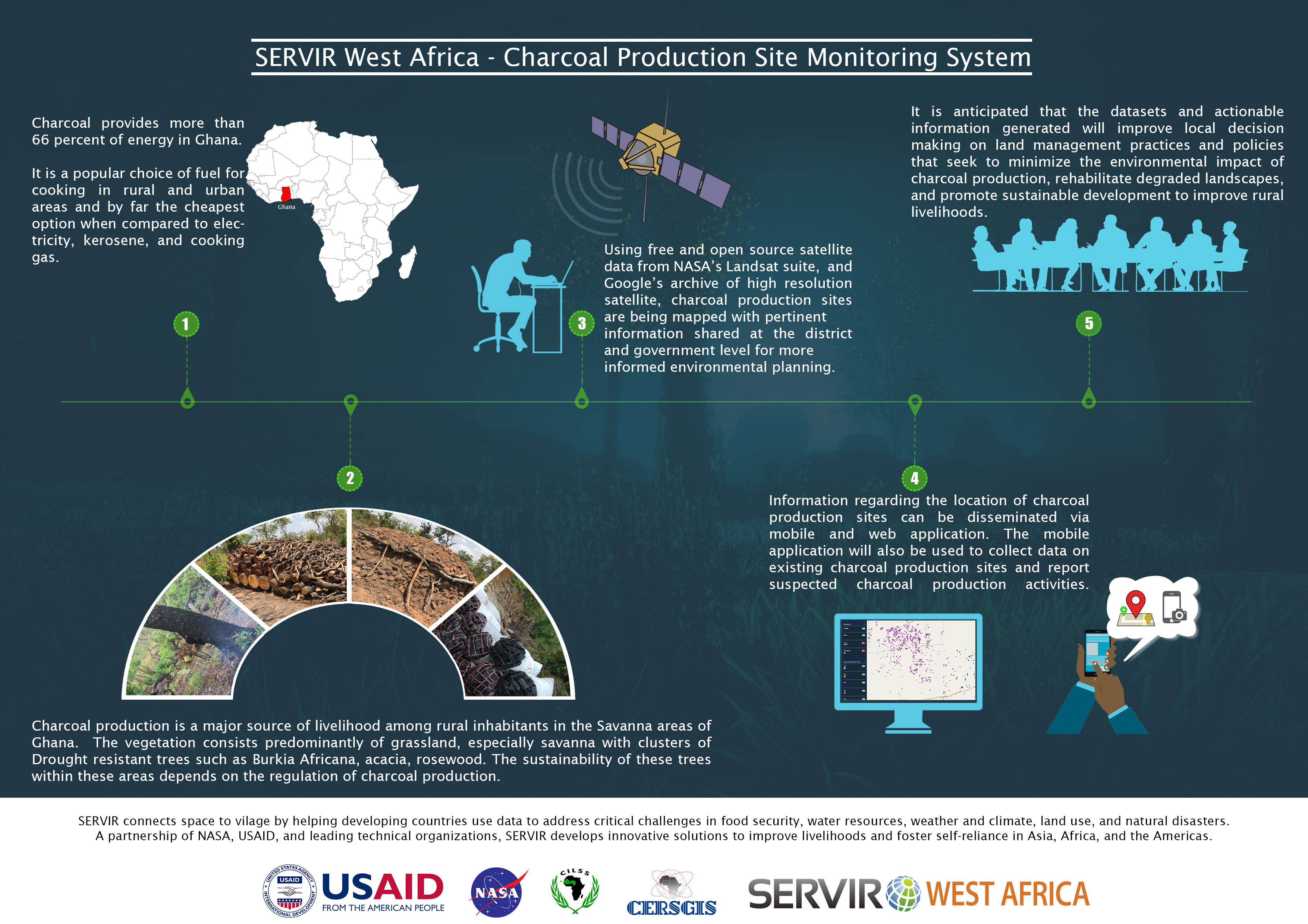
Charcoal Production Monitoring Portal is developed by CERSGIS, with support from USIAD/NASA and CLISS uder the SERVIR West Africa project. We also recived ground support from Arocha Ghana and the Enviromental Protection Agency.


Please do not hesitate to contact us. What ever the case from personal enquiry to requesting for technical support. We are at your service